ISS Photograph Captures Midwest City Lights Before Sunrise
A clear predawn view links urban lighting with the glow of Earth’s upper atmosphere.
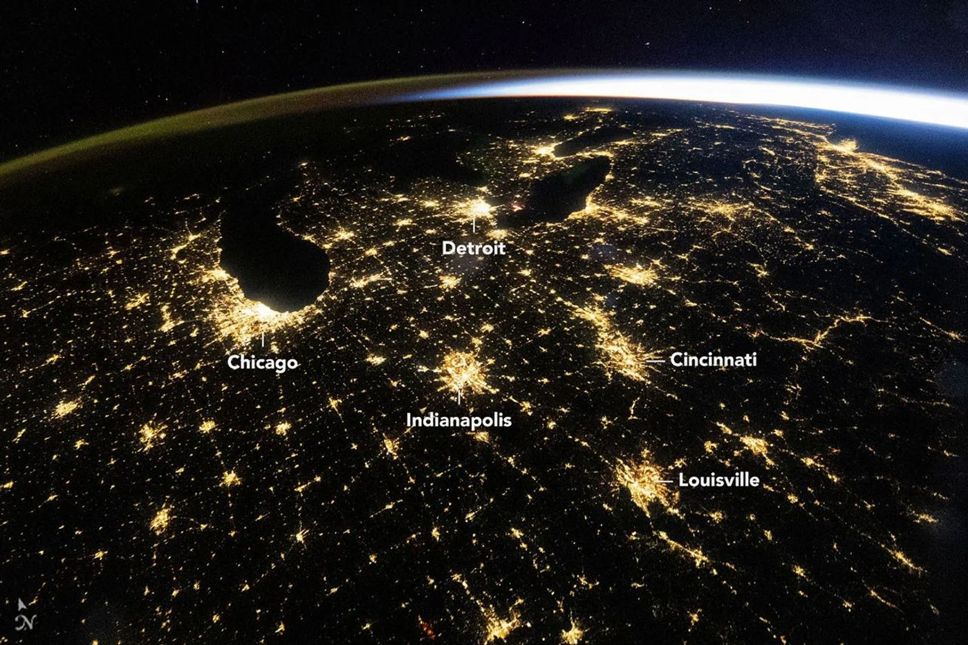
An early-morning panorama
An astronaut aboard the International Space Station photographed the eastern United States before dawn on October 18. NASA’s November 4 image report shows illuminated metropolitan areas spread across a largely cloud-free landscape.
Cities and the horizon
Chicago and Detroit stand out among the brightest clusters, while roads and smaller settlements help connect the scene. Along the curved horizon, colored airglow appears beside the approaching light of sunrise. The photograph was taken at 09:54 UTC.
More than a scenic view
NASA explains that nighttime observations can support research into how cities and their lighting change. Detailed records can also help examine electricity outages and restoration. This single view, however, is not a direct measure of a city’s population or economic performance.
Background and interpretation. The following sections add editorial explanation to the dated report. Hypothetical examples are illustrations, not newly reported events or interviews.
The photograph combines several kinds of light
The city lights are the easiest features to recognize, but they are not the only luminous elements in the scene. The horizon and approaching daylight create a different visual layer from the light associated with settlements. The photograph therefore combines human geography with the conditions under which the Earth was viewed. Reading those layers separately helps prevent a common mistake: interpreting every bright patch as a city or every coloured band as the same atmospheric phenomenon. The source identifies the scene; the wider explanation begins by respecting the differences among the things visible within it.
A camera view is not a flat map
An astronaut photograph can look like a map because familiar locations are spread across a broad surface. However, an oblique view compresses distance toward the horizon and presents the Earth from a particular angle. Features near the foreground and features near the edge of the visible surface do not necessarily have the same apparent scale. A viewer trying to estimate separation should therefore consult geographic information rather than measure equal pixel distances across the entire image. The photograph is a perspective view of geography, not a substitute for a uniformly scaled cartographic projection.
Why recognition can be both useful and misleading
Recognizing a bright metropolitan cluster helps orient the viewer. Once that orientation is established, smaller patterns become easier to follow. Familiarity can also create overconfidence: a bright area may seem obvious enough that the reader stops checking its identification. A useful habit is to compare the source's labels with the surrounding pattern rather than rely on one isolated light. The same logic applies to a road-like line. Its appearance may be suggestive, but identifying a specific transport corridor requires a map or a source attribution, not merely a resemblance.
Brightness does not directly count residents
A photograph of illuminated settlements is not a population census. The amount of light visible from a place depends on what is emitting it and on the conditions of observation, as well as on how the photograph is processed and displayed. A densely populated area and an intensely lit facility need not have the same visual signature. For that reason, this scene should not be used to rank living standards, count households or infer the number of people awake. Those questions require data designed for them and a clear explanation of the relationship being measured.
A hypothetical before-and-after comparison
Imagine looking at two photographs of the same city taken on different nights. One appears dimmer. Before concluding that the city lost power or reduced electricity use, a reader would need comparable camera settings, atmosphere, viewing angle and coverage. They would also need to know whether the same area was actually visible. This hypothetical example illustrates why a visually simple comparison can hide a complicated measurement problem. A change in displayed brightness may be worth investigating, but it should be framed as a question until the relevant controls and independent information are available.
The transition from night to morning
The approaching dawn makes the timing of this photograph part of its subject. A city-light view taken before sunrise can show a very different balance of land, atmosphere and illumination from one taken later. The source's UTC timestamp identifies the observation, while local time depends on the location within the frame. When a photograph spans a large area, a single casual description such as early morning can obscure those geographic differences. Keeping the timestamp alongside the picture allows a reader to understand the context without pretending that every visible place experienced precisely the same local moment.
What the dark spaces contribute
Dark areas are not merely empty gaps between bright cities. They provide contrast and help reveal the distribution of visible light across the landscape. Yet darkness alone does not identify a land use or establish that a place is uninhabited. The image's conditions can limit what is seen, and some kinds of activity produce little visible light from above. A careful reading therefore avoids turning the dark portions into unsupported social judgments. The pattern is informative as a pattern, while explanations of the places within it require additional geographic and contextual evidence.
How to use the image in an educational setting
A productive exercise is to separate observation from identification. First, describe the visible features without naming them: clusters, lines, a curved horizon and bands of light. Next, compare those descriptions with the source's labels. Finally, list questions the photograph cannot answer, such as the population of a city or the cause of a particular light source. This sequence makes the image accessible without demanding specialist equipment. It also shows how a familiar scene can support careful reasoning rather than simply reward the person who recognizes a skyline or a regional outline first.
A human view with a documented context
The photograph's appeal comes partly from the fact that it connects everyday places with a view from orbit. That connection does not require overstating what the camera records. Its value lies in the broad arrangement, the clear timing and the relationship between settlement lights and the changing horizon. Keeping the original image credit and source link preserves the record of how the scene entered public view. The expanded explanation adds a way to read it; it does not claim a new measurement of urban growth, electricity demand or atmospheric conditions beyond the evidence cited.
Camera brightness is not a standardized light meter
The appearance of a photograph depends partly on choices made during capture and display. A bright-looking patch in a published image does not come with a universal conversion into electricity use or emitted light. Those quantities would need a measurement designed for that purpose. This helps explain why an astronaut photograph is valuable as a documented view without being treated as a ready-made numerical dataset. Readers can appreciate the contrast and identify geographic patterns while asking a separate question whenever a claim moves from visible brightness to a physical quantity that the image caption did not report.
Brightness is affected by the light source, camera settings, atmosphere and viewing geometry. Comparisons between cities or dates require consistent methods. A beautiful orbital photograph is a starting point for questions about urban development, not a substitute for the measurements needed to answer them.
Source & verification
This independently written summary is based on NASA’s original report, released 2026-11-04. Consult the source for research details, methods and subsequent updates. NASA does not sponsor or endorse this publication.
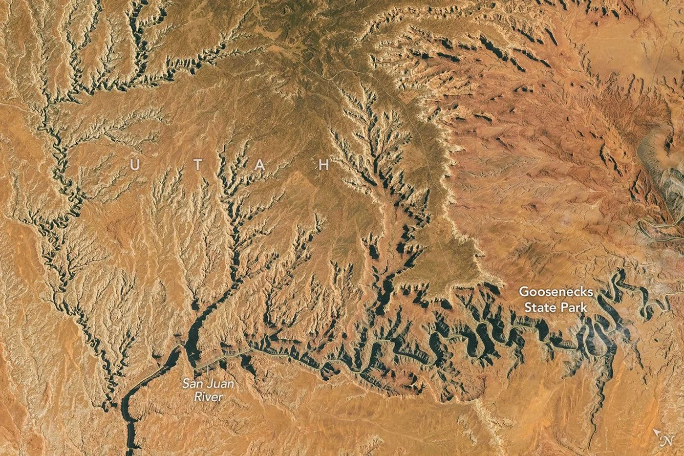 Astronaut Photograph Follows Utah’s Deeply Winding San Juan River
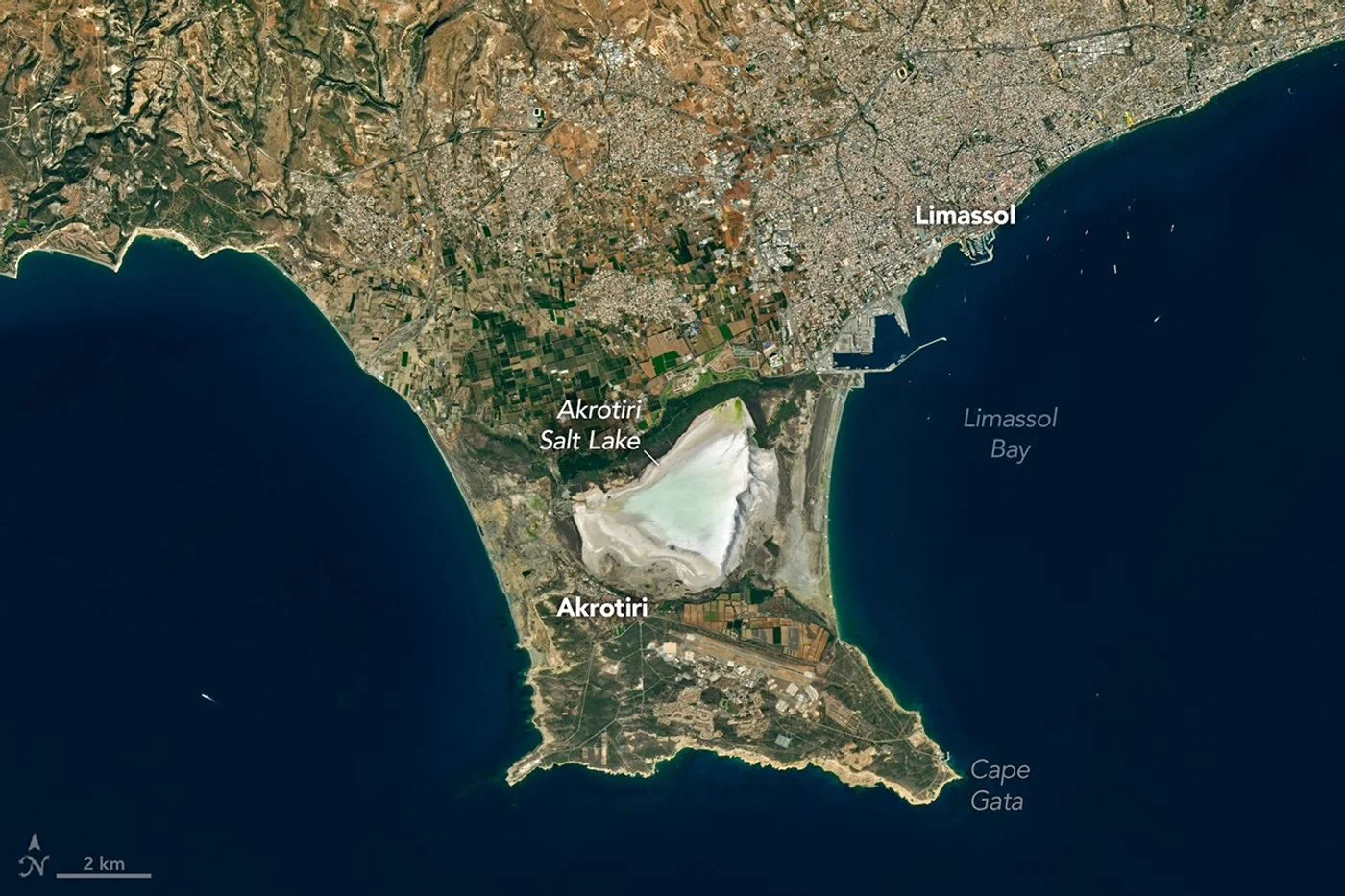 Landsat View Reveals the Changing Shores of Southern Cyprus